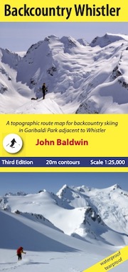
scale 1:25,000
contour interval 20m
27" X 34"
folds to 4.25" X 9"
full colour front and back
waterproof and tearproof
30 colour photographs
ATES map
11,000 words of text
Second Edition
ISBN 978-0-9919479-1-1
$25.00

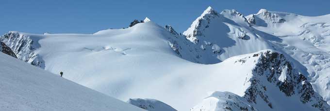
Kees and Claire Hut
Photo by Carol Evenchick
BACKCOUNTRY WHISTLER
A topographic map showing routes for ski mountaineering, backcountry skiing, steep skiing and hiking in the Coast Mountains near WhistlerJohn Baldwin
Backcountry Whistler is a topographic route map for the mountains of northern Garibaldi Park adjacent to and beyond Whistler-Blackcomb ski resort. Route information for ski mountaineering, backcountry skiing, steep skiing and hiking is marked on a large scale 1:25,000 map and accompanied by detailed descriptions on the back of the map. The map covers the Spearhead and Fitzsimmons Ranges, which offer some of the finest and most accessible ski mountaineerimg in the Coast Mountains. The terrain varies from extensive alpine areas with glaciated summits to open meadows, glades and steep forest. Backcountry ski trips varying from a few hours to four or more days, range from rolling tours with gentle glade skiing to high-alpine ski ascents with long glacier runs and steep couloirs.
Includes the popular Spearheads Traverse, which crosses a dozen glaciers en route from Blackcomb to Whistler ski areas, and is often described as one of the 50 best backcountry ski trips in North America.
Features:
- Waterproof, Tearproof
- Routes marked on the map for ski mountaineering, backcountry skiing, steep skiing and hiking
- Self contained guidebook on back of the map
- 1 km UTM grid lines
- Table of slope angle relative to contour spacing
- Crevasses
- Detailed forest cover from satelitte imagery
- map of avalanche terrain ratings
- subtle shaded relief
- Metric conversion
- Online terrain gallery
Reviewer's Comments for First Edition:
"For more inside dope, get a copy of John Baldwin's 'Backcountry Whistler'. a great map that details all major routes." Alex Markels, National Geographic Adventure
"John Baldwin has produced the most comprehensive map resource yet for the Spearhead and Fitzsimmons Ranges east of Whistler Village." Charles Montgommery, Explore
"With dozens of touriing and ski descent routes clearly marked on a 1:25,000 large scale map, John Baldwin's Backcountry Whistler is an indispensible sheet for any who venture here.....getting a copy of this map before heading north might be your best piece of advice." Steve Threndyle, Couloir
"I have to say, I am very impressed with the Backcountry Whistler Map... it's a good hybrid between resort leaflet and mountaineer technicality."
" The Whistler area has to be the most overly mapped region · but most of the product is actually less useful than the standard 1:50,000 sheets. Yours seems to finally hit the nail on the head."
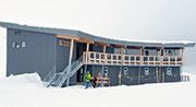
Support the Spearhead Huts
$1 from the sale of every copy of Backcountry Whistler will be donated to the Spearhead Huts Project. For more information see Spearhead Huts Project.