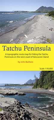
scale 1:50,000
contour interval 100ft
18" X 24"
folds to 4.25" X 9"
full colour
waterproof and tearproof
ISBN 978-0-9691550-4-1
$19.95

TATCHU PENINSULA
A topographic route map for hiking the Tatchu Peninsula on the west coast of Vancouver Island, BCJohn Baldwin
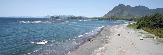
Tatchu Peninsula describes a coastal hiking route along the rugged Tatchu Peninsula on the west coast of Vancouver Island, BC. The route is marked on a 1:50,000 scale topographic map and includes information on distances and hiking times, recommended campsites, tide cutoffs, sources of drinking water and noteworthy features.
Features:
- customized topographic map
- detailed hiking route
- distances and hiking times
- recommended campsites
- tide cutoffs
- sources of drinking water
- 1 km UTM grid lines
- latitude and longitude
- three-dimensional shaded relief
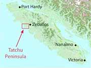
- covers parts of 92E/14 and 92E/15
Tatchu Peninsula is a customized topographic map based on the Canadian NTS Topographic maps and is printed on water-resistant/tearproof synthetic stock.